Outer Banks septic guide
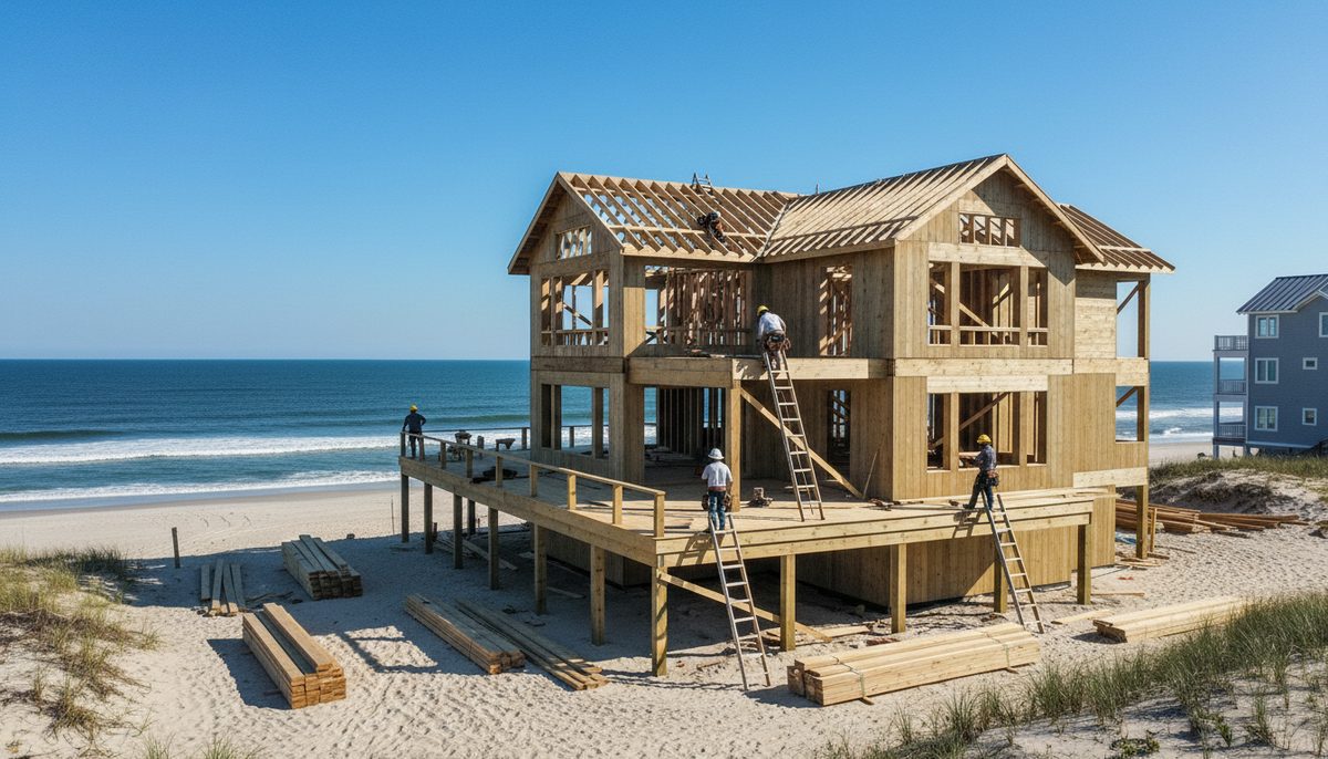
How high does a house have to be elevated on the Outer Banks?
Elevation here is floodplain arithmetic: the Base Flood Elevation from the 1%-annual-chance flood, Dare County's eight-foot-or-greater local standard, and an RFPE that reaches even into X zones.
The honest answer is that nobody's preference is in the number. Elevation on this coast is computed: it starts from the mapped flood the federal government prices your lot against, adds a county standard most mainland owners have never heard of, and lands on a figure your foundation has to respect before the first piling is driven. Here is the arithmetic, layer by layer.
The details
The base of the math is federal: BFE tied to the 1%-annual-chance flood — the Base Flood Elevation is set by the FIRM maps to the flood having a one-percent chance of being equaled or exceeded in any given year, the storm the shorthand calls the hundred-year flood without meaning it happens once a century. Your lot's BFE is the reference elevation everything else builds on, and with the county's freeboard standard it determines the Regulatory Flood Protection Elevation a new structure must meet.
Then the county layer, which is where the number gets real: Dare County local elevation standard — Dare County's local elevation standard applies to all property in unincorporated Dare County and requires structures elevated to eight feet or greater, depending on flood zone and natural topography. Read that carefully: eight feet or greater, meaning the county's floor is the starting point and your lot's zone and ground can push it higher.
And then the surprise, which is how far the requirement reaches: RFPE applies even in X zones — the county applies its locally adopted Regulatory Flood Protection Elevation in Shaded X and X Zones, not merely the AE and VE zones of the mapped floodplain. Translation: a lot outside FEMA's hundred-year flood lines is still inside Dare County's elevation rules. 'My lot isn't in a flood zone' has never once ended the conversation here.
What this means for a build: the elevation question is answered by the zone map plus the county standard before an architect draws anything, because the number decides the piling length, the stair count, the deck rail heights, the whole silhouette of the house. It is also why two neighbouring lots can owe different elevations — the arithmetic is per-lot. We pull the zone, the BFE, and the county standard as the first step of every foundation we design, because every other dimension of the house hangs off that one number.
One-percent flood, county freeboard, eight feet or greater — compute it before you draw it, and the house starts on the number it has to live with.
On the record: Dare County local elevation standard (Dare County, NC — Build Responsibly, Local Elevation Standards (darenc.gov, retrieved 2026-09-17)) · BFE tied to the 1%-annual-chance flood (Dare County, NC — Know Your Flood Zone (darenc.gov, retrieved 2026-09-17)) · RFPE applies even in X zones (Dare County, NC — Know Your Flood Zone (darenc.gov, retrieved 2026-09-17))
Hand-verified 2026-09-17 against the primary sources named above; where a fact could not be verified it was left out, never guessed.